dylanbeaudette
Active member
Hi everyone,
I've been collecting some interesting flight data via telemetry on my FrSKY transmitter with this interesting GPS module:

 alofthobbies.com
In short, this device interfaces with an SBUS or F.Port compatible receiver and sends back all kinds of interesting "sensor" data back as telemetry. GPS date/time, elevation, speed, and coordinates. For example, speed:


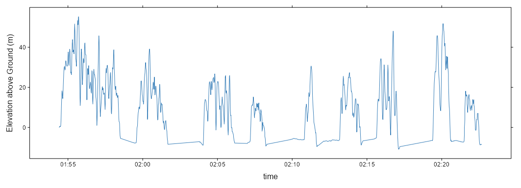
Note that the my time zone offset hasn't been correctly set--I wasn't actually flying at 2am in the morning. Still there is sufficient (apparent) precision to do a lot with these data in terms of understanding flight characteristics--maybe.

Looking at the GPS coordinates, I realize that something isn't right; they appear to be truncated. Note the snapping effect in the following map:

Looking over the raw data, from the transmitter log file, I see that the "GPS" sensor is returning a single string containing latitude and longitude combined:
"38.032500 -120.407600"
For some reason, the last two digits have been set to 0. On the transmitter, in the telemetry display, the GPS coordinates are formatted in "degree minute second" (DMS) notation with 2 decimal places in the seconds. Like this: -120° 33′ 5.36″. This formatting implies 4 decimal places of precision (120.5649) when using decimal degrees (DD).
OK, the telemetry log matches the telemetry screen even though one is formatted as DMS and the other as DD. Two questions
I'm wondering if a more advanced telemetry processing script could solve the problem. For example: https://github.com/moschotto/OpenTX_GPS_Telemetry
I'll give this a try and report back.
Dylan
I've been collecting some interesting flight data via telemetry on my FrSKY transmitter with this interesting GPS module:

FrSky GPS ADV Sensor
The FrSky GPS ADV sensor provides accurate synchronization with GPS satellites and provides telemetry for groundspeed, GPS position, UTC Time and altitude. It works with any Smart port capable receiver but what's new is F.Port/FBUS capability, allowing for even faster telemetry. Dimensions 45 x...
In short, this device interfaces with an SBUS or F.Port compatible receiver and sends back all kinds of interesting "sensor" data back as telemetry. GPS date/time, elevation, speed, and coordinates. For example, speed:


Note that the my time zone offset hasn't been correctly set--I wasn't actually flying at 2am in the morning. Still there is sufficient (apparent) precision to do a lot with these data in terms of understanding flight characteristics--maybe.

Looking at the GPS coordinates, I realize that something isn't right; they appear to be truncated. Note the snapping effect in the following map:

Looking over the raw data, from the transmitter log file, I see that the "GPS" sensor is returning a single string containing latitude and longitude combined:
"38.032500 -120.407600"
For some reason, the last two digits have been set to 0. On the transmitter, in the telemetry display, the GPS coordinates are formatted in "degree minute second" (DMS) notation with 2 decimal places in the seconds. Like this: -120° 33′ 5.36″. This formatting implies 4 decimal places of precision (120.5649) when using decimal degrees (DD).
OK, the telemetry log matches the telemetry screen even though one is formatted as DMS and the other as DD. Two questions
- does the transmitter have access to the full precision possible with GPS?
- is the GPS device only capable of sending this level of precision due to telemetry protocol limitations
I'm wondering if a more advanced telemetry processing script could solve the problem. For example: https://github.com/moschotto/OpenTX_GPS_Telemetry
I'll give this a try and report back.
Dylan

